E4 Path in Crete
The E4 Path is a remarkable long-distance trail that stretches across Europe, covering a total distance of 10,450 km. Starting in Tarifa, Spain, and ending in Cyprus, this path is a diverse and thrilling adventure for hikers and nature enthusiasts.
One of its most captivating segments can be found on the island of Crete, where the path extends for approximately 500 km, offering some of the most stunning landscapes and unique hiking experiences.
In Crete, the E4 Path begins at Kastelli in the western coast and culminates at Kato Zakros in the eastern coast, traversing through the island’s breathtaking mountains, peninsulas, and gorges (We Love Crete). Hikers exploring this section of the path and its surroundings will find themselves immersed in the island’s natural beauty, such as the mountains of Dikti, Psiloritis, and Asterousia, the coastal paths, as well as the famous Samaria Gorge (Trail Path) and lesser known but just as impressive places, such as the Imbros Gorge and the Aradena Gorge. The E4 Path provides access to some of the most picturesque locations, rich history, and authentic Cretan culture that the island has to offer.
Overview of the E4 Path
The E4 Path is a renowned walking trail that stretches across the island, offering an excellent opportunity for hikers and nature enthusiasts to explore the region’s diverse landscapes. The trail covers approximately 500 km, starting from Kastelli in the west and ending at Kato Zakros in the east.
The trail takes participants on a journey through various terrains, including forests, gorges, rugged mountains, and coastal paths. Along the way, hikers will have the chance to visit important sites, such as the ancient plateau of Nida and the forest of Rouvas.
The E4 Path in Crete is divided into several sections, allowing hikers to choose the areas that best suit their interests and abilities. Some of the most popular segments include:
The Zakros to Chrisoskalitisa (Elafonissi) trail, traversing the island from west to east or vice versa.
The Mountain Desert of the White Mountains, which crosses one of the most demanding and mystical landscapes in Crete (Cretan Beaches).
Two distinct branching paths at Sougia and Fragokastello, which offer alternative trail options to explore.
Overall, the E4 Path in Crete provides a unique and varied experience, allowing hikers to appreciate the island’s rich natural beauty and history. Whether you choose to complete the entire trail or opt for smaller sections, it’s undoubtedly an adventure worth considering.
E4 Path Route Details
Trail Length and Duration
The E4 Path in Crete is part of the larger European E4 Path that spans a total of 10,450 km, beginning in Spain and ending in Cyprus. The Crete portion covers some of the island’s highest mountains and most beautiful beaches as well as exploring less-visited parts of the country (Discover… on Foot). The actual length of the E4 Trail in Crete may vary depending on the specific route chosen and the conditions of the path.
Starting and Ending Points
The E4 Path in Crete starts in the west at Kastelli and ends in the east at Kato Zakros. Before that, it stretches through the Peloponnese region in Greece before hopping over to Crete via boat.
Major Stops Along the Way
As the E4 Trail traverses Crete and the island’s mountain range, hikers will encounter several major stops, which include:
The White Mountains (Lefka Ori) – offering stunning views and challenging hikes.
Mount Psiloritis (Mount Ida) – the highest peak in Crete.
Samaria Gorge – a beautiful canyon and a UNESCO Biosphere Reserve.
Elafonisi Beach – famous for its pink sand and clear turquoise waters.
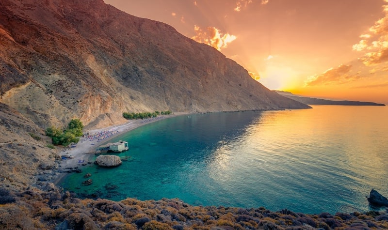
While these are some highlights of the E4 Path in Crete, the trail also passes through numerous other interesting locations. Ancient ruins, traditional villages, picturesque landscapes and hidden beaches along the south coastal path make for some beautiful scenery.
Best Time to Hike the E4 Path
When planning a hiking adventure, choosing the right time of the year is essential for an enjoyable experience. For the E4 Path in Crete, the best months to hike are from April to June. This period allows hikers to explore the trail comfortably, as the temperatures haven’t yet reached the summer highs expected from a Greek island.
Aesthetically, another advantage of hiking between April and June is the opportunity to witness the famous Cretan wildflowers in full bloom. The vibrant colors and sweet scents of these flowers create a magical atmosphere along the trail, enhancing the overall experience. Additionally, the weather in Crete during these months is generally mild, with pleasant temperatures and limited rainfall, further contributing to favorable conditions for hikers.
It’s important to note that the E4 Path consists of numerous sections with varying levels of difficulty, and some sections may be more challenging than others. As you plan your hiking expedition, take into consideration your fitness level, hiking experience, and the specific sections you intend to explore. A comfortable coastal route is a completely different experience from a hard path through a mountain range. Ensure you will have a safe and enjoyable journey through Crete’s scenic landscapes.
Terrain and Difficulty
The E4 Path in Crete offers a diverse range of terrains for hikers, from simple walking on asphalt roads to more challenging hikes in rugged gorges and mountain trekking. To help navigate the varying degrees of difficulty along the 500 km path, it is divided into different sections that showcase Crete’s beautiful scenery and interesting hiking experiences while helping with picking the ideal route.
The E4 Path is characterized by a number of terrains, including coastal paths, forest trails, and steep mountain climbs. Some areas of the trail are overgrown and difficult to follow, while others have better marking and maintenance.
In general, hikers should be prepared to encounter a variety of terrain conditions and difficulty levels along the E4 Path. The table below provides a brief outline of the typical terrains encountered:
Terrain Type Description
- Asphalt roads, easy walking paths, suitable for all levels of hikers
- Forest trails are generally well-marked and maintained, offering moderate challenges and picturesque surroundings
- Rugged gorges, demanding hikes that may require scrambling, climbing, or traversing uneven terrain
- Mountain trekking, very challenging sections, best suited for experienced hikers with proper gear and fitness levels
It is essential for hikers to plan their travels along the E4 Path in Crete based on their abilities and preferences, as well as to carry appropriate gear and provisions.
The E4 Path in Sfakia
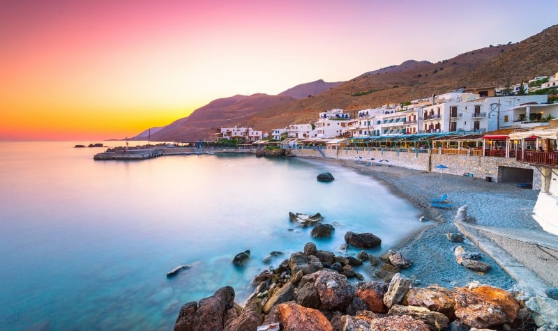
The E4 Path in Sfakia is a popular and scenic hiking route on the island of Crete. This section of the trail offers a mix of coastal and mountain landscapes, providing stunning views for hikers. The trail is well-marked with the typical E4 black-yellow signs, making navigation relatively straightforward.
One of the highlights of the E4 Path in Sfakia is the route connecting Chora Sfakion to Agia Roumeli. This hike takes you through rugged terrain and offers exceptional glimpses of the surrounding mountains and coastline. The walk from Agios Pavlos to Chora Sfakion is another popular segment and is rated 4.2 by hikers on AllTrails.
The E4 Path in Sfakia is suitable for a multi-day hike, spanning approximately 80-90 kilometers over 6 days and 5 nights. It is recommended to plan your hike carefully and ensure that you have adequate supplies, clothing, and accommodations for the duration of the trip.
You can find a brief summary of key points in this section:
Scenic hiking route in Sfakia with coastal and mountain landscapes
Well-marked trail with E4 black-yellow signs
Highlights include the routes from Sfakia to Agia Roumeli and Agios Pavlos to Chora Sfakion
Suitable for a multi-day hike spanning approximately 80-90 kilometers


